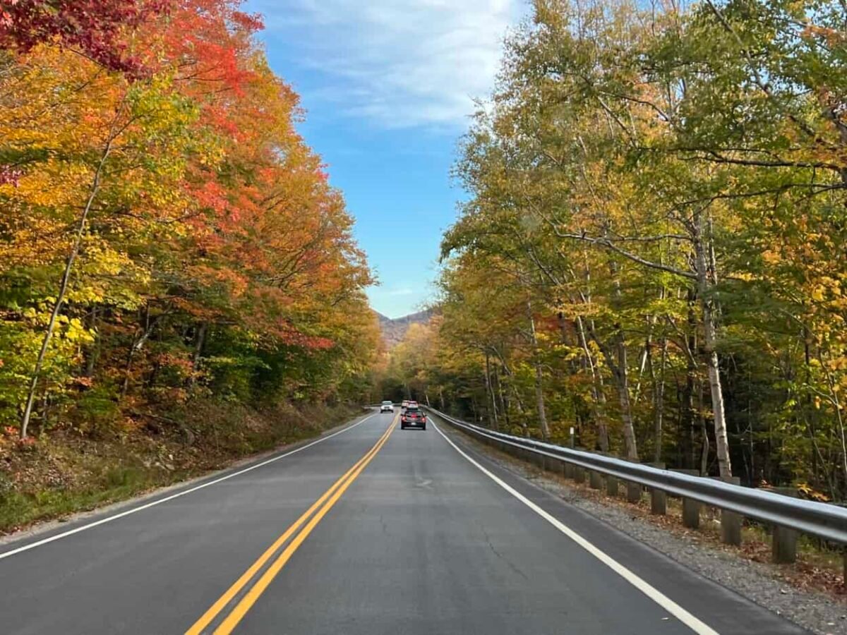
One of America’s most scenic drives has a strange-looking name and nestles in an often overlooked state. The Kancamagus Highway, pronounced (Kan-kuh-MOG-us), winds through New Hampshire’s White Mountains, offering easy access to stunning scenery and fun side adventures.
If you have yet to drive through New Hampshire in the fall, we suggest you load up the car and explore the Granite State this year. Julie and I love the “Kanc” so much that we have driven it twice in three years.
Although beautiful year-round, New Hampshire’s vibrant fall colors are some of the best we have seen. The Kancamagus Highway showcases the state’s natural beauty and provides a unique mix of things to see and do. Let’s explore the scenic byway so you can plan your road trip adventure.
Disclosure: This post may contain affiliate links. If you make a purchase through one of these links, I may earn a small commission at no additional cost to you. Thanks for keeping Miles with McConkey going!
What’s With the Name?
The Kancamagus Highway is recognized as a national scenic byway. It is sometimes called the Kancamagus Scenic Byway or simply “the Kanc.”
The scenic road is named for Chief Kancamagus, the last chief of the Penacook Confederacy, a Native American tribe that inhabited the New England area. Legend says his name means the “Fearless One.”
Where Is This Magical Road?
The Kancamagus Highway comprises a 34.5-mile stretch of NH Route 112 in the north-central part of the state. Running east to west, it connects the towns of Conway and Lincoln.
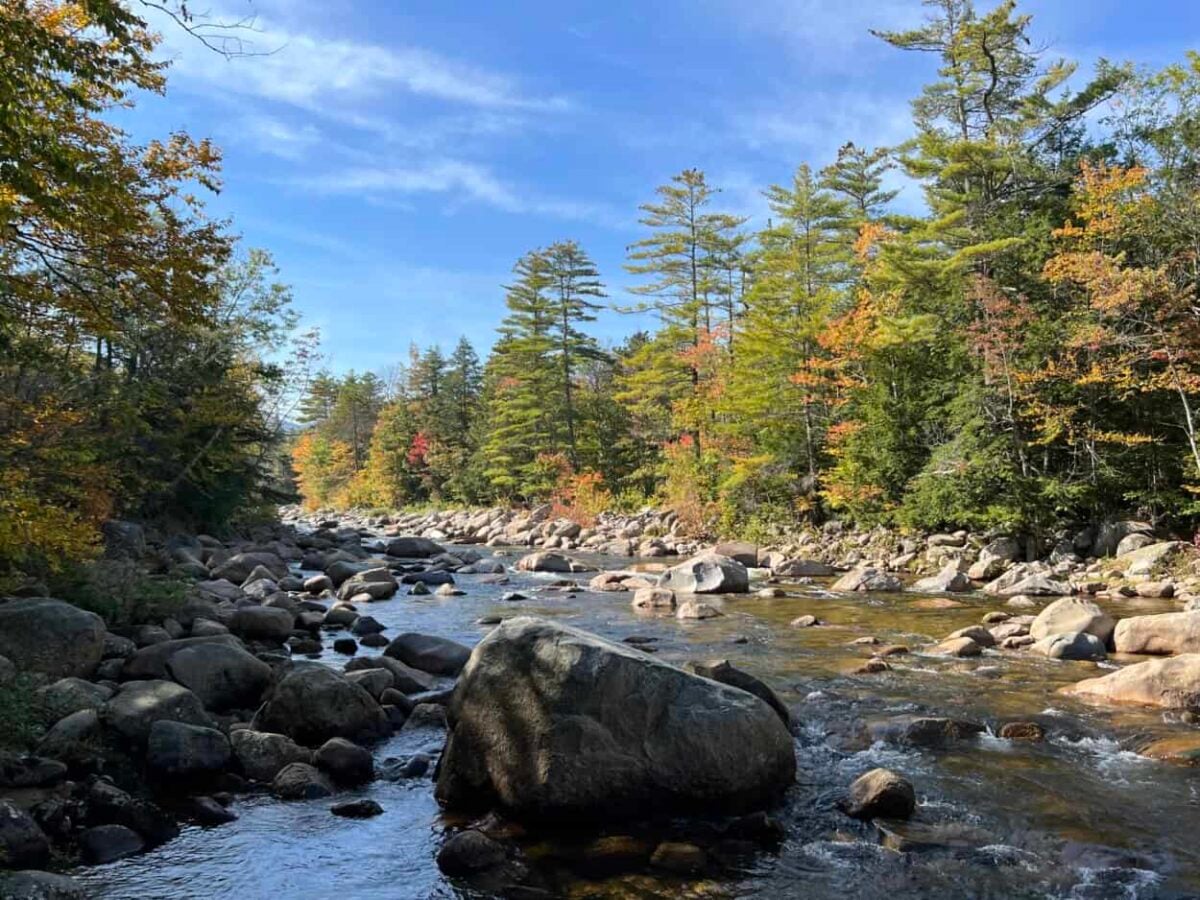
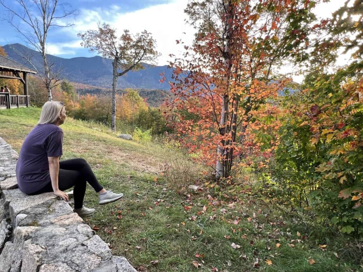
The drive offers much more than glimpses of vibrant fall foliage. Quick roadside stops, scenic overlooks, and hiking trails treat travelers to views of the majestic White Mountains, peaceful forests, rock-filled rivers, and cascading waterfalls.
Want a sneak peek before you hit the road? Take a virtual ride with our video tour of the Kancamagus Highway.
Essential Information
You can start the drive in either Conway, to the east, or Lincoln, to the west. Pullouts sit on each side of the road. You will discover more waterfalls and roadside stops closer to Conway, while more overlooks with mountain views are concentrated near Lincoln. Julie and I drove the Kanc both times, starting in Conway.
The Kancamagus Highway sees the most drivers in autumn. We encourage you to start early in the morning to experience lighter traffic. By 10 am, we noticed significantly more cars on the road. Going on a weekday is preferred to the busier weekends.
The road is fully paved. It is steep in spots but only has one hairpin turn, which sits near the Hancock Overlook. While you will find restrooms at a few stops, no gas stations or restaurants are along the Kancamagus Highway. Be sure to fuel up before starting your journey, and pack food and water.
Although driving the Kancamagus Highway is free, some parking areas and trailheads require a recreation pass. A day pass costs $5 for the car and covers you for all stops on the scenic byway.
How Long Does it Take to Drive the Kancamagus Highway?
The drive should take close to an hour without stopping. Plan at least three hours to enjoy a few overlooks and roadside stops. To genuinely experience the Kanc, we recommend a half-day to savor the side adventures and short hikes or a full day if you plan to do any of the longer hikes.
When Is the Best Time to Go?
The scenery along the White Mountain National Forest and its namesake peaks is beautiful year-round. Autumn is the most popular time to drive the Kancamagus Scenic Byway due to the brilliant colors that paint the landscape. Since peak foliage differs each year, it can be challenging to pinpoint the best time to plan your road trip.
Peak foliage along the Kanc regularly occurs in the first two weeks of October. Visit the New Hampshire fall foliage tracker site. for conditions and predictions.
Now that you know the basics, we will cover what you can expect starting from Conway. If you plan to begin your journey from Lincoln, the adventures will be in reverse order.
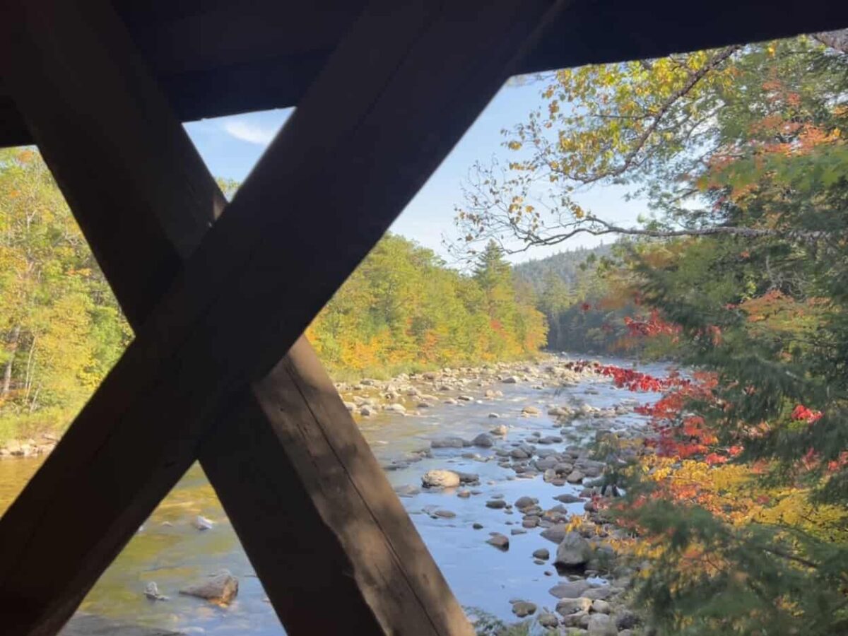
Albany Covered Bridge (6.1 Miles)
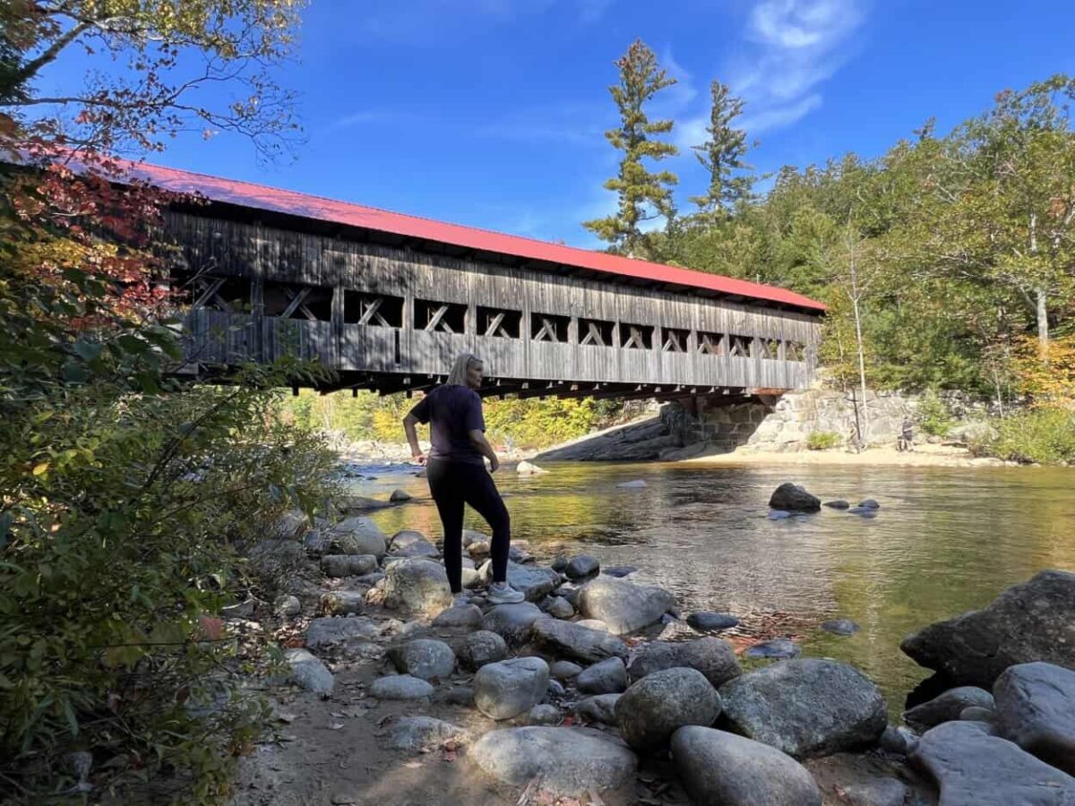
While Vermont is renowned for covered bridges, New Hampshire also proudly boasts lovely historic overpasses. One of them is on the Kancamagus Highway.
The Albany Covered Bridge spans the Swift River and is fun to drive or walk across. It was constructed in 1858 and renovated in 1970. Please note that the bridge has a 7′ 9″ height restriction for vehicles. Although it is closed to cars in winter, you can still walk across. Hikers can access the Boulder Loop Trail near the Albany Covered Bridge. It is approximately a 3-mile round-trip hike through the woods.
Julie and I love covered bridges, so we thoroughly enjoyed our time here. With large rocks in the flowing river, the Albany Covered Bridge is an excellent photo opportunity. You can also capture unique photos through the side panels of the bridge when you walk across.
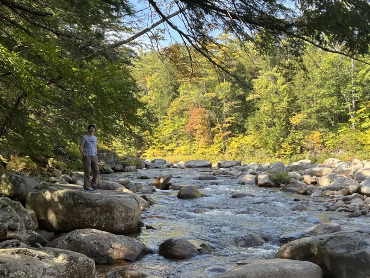
Lower Falls Scenic Area (6.8 Miles)
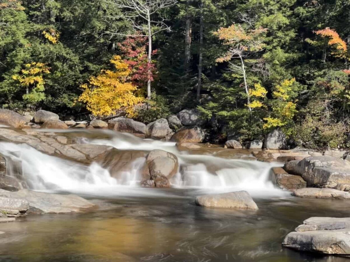
A quick stop at Lower Falls yields beautiful views of the Swift River coursing over large granite rocks. The sound of the gurgling water and the sight of autumn colors fill your soul with joy, so you may want to linger.
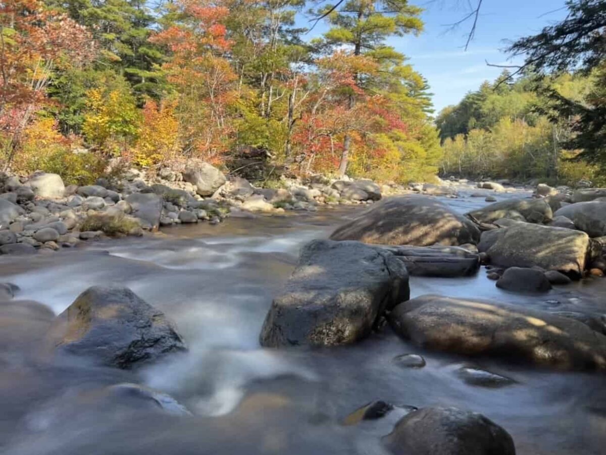
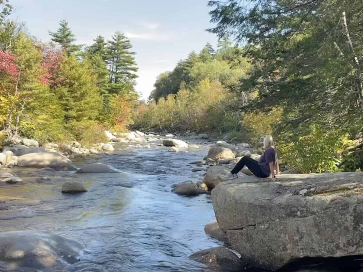
Rocky Gorge (9 Miles)
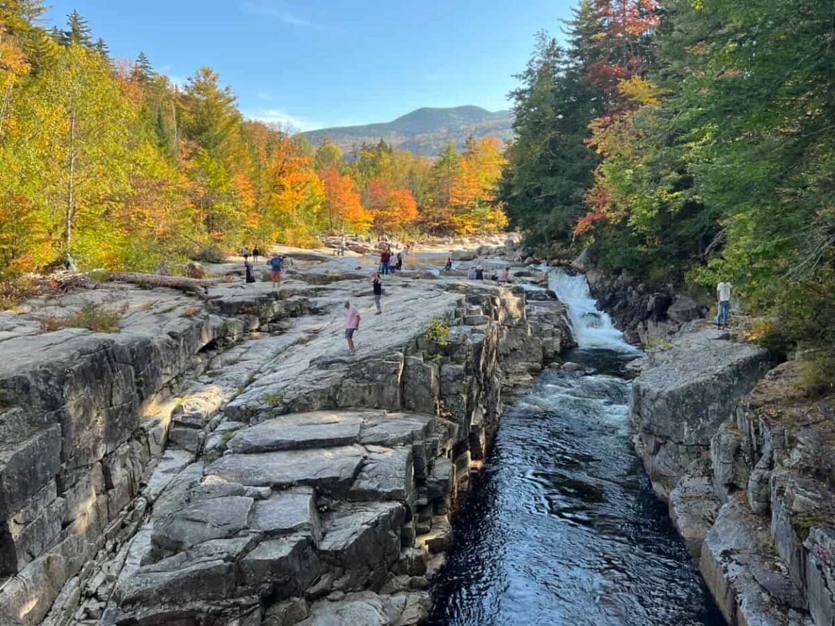
One of the most picturesque stops on the Kancamagus Highway, Rocky Gorge, is a must. The Swift River ripples through a narrow flume, culminating in a small but mesmerizing waterfall. When the water level is low, which was the case both times we visited, visitors can walk onto the rocks.
You will also find a footbridge here for excellent views and photos. After walking across the bridge, you can continue up a small hill to the Lovequist Loop, a roughly 1-mile hike that takes you around Falls Pond, a lovely pond surrounded by trees. Visitors often skip this hike, so it is an opportunity to enjoy nature’s solitude.
Julie and I enjoyed walking across the bridge and on the rocks to get different perspectives of the gorge and its waterfall. Although it regularly gets crowded here, the beauty of Rocky Gorge is undeniable.
As you continue driving west on the Kancamagus Highway, you will see a sign for Champney Falls shortly after Rocky Gorge (10.5 miles). The trailhead sits just off the parking area. A 3-mile round-trip hike leads to a series of 70-foot cascades. Julie and I did not hike to Champney Falls. Fellow travelers advised us that it is spectacular at high water levels but lackluster during drier periods.
Russell-Colbath Historic Site (12.5 Miles)
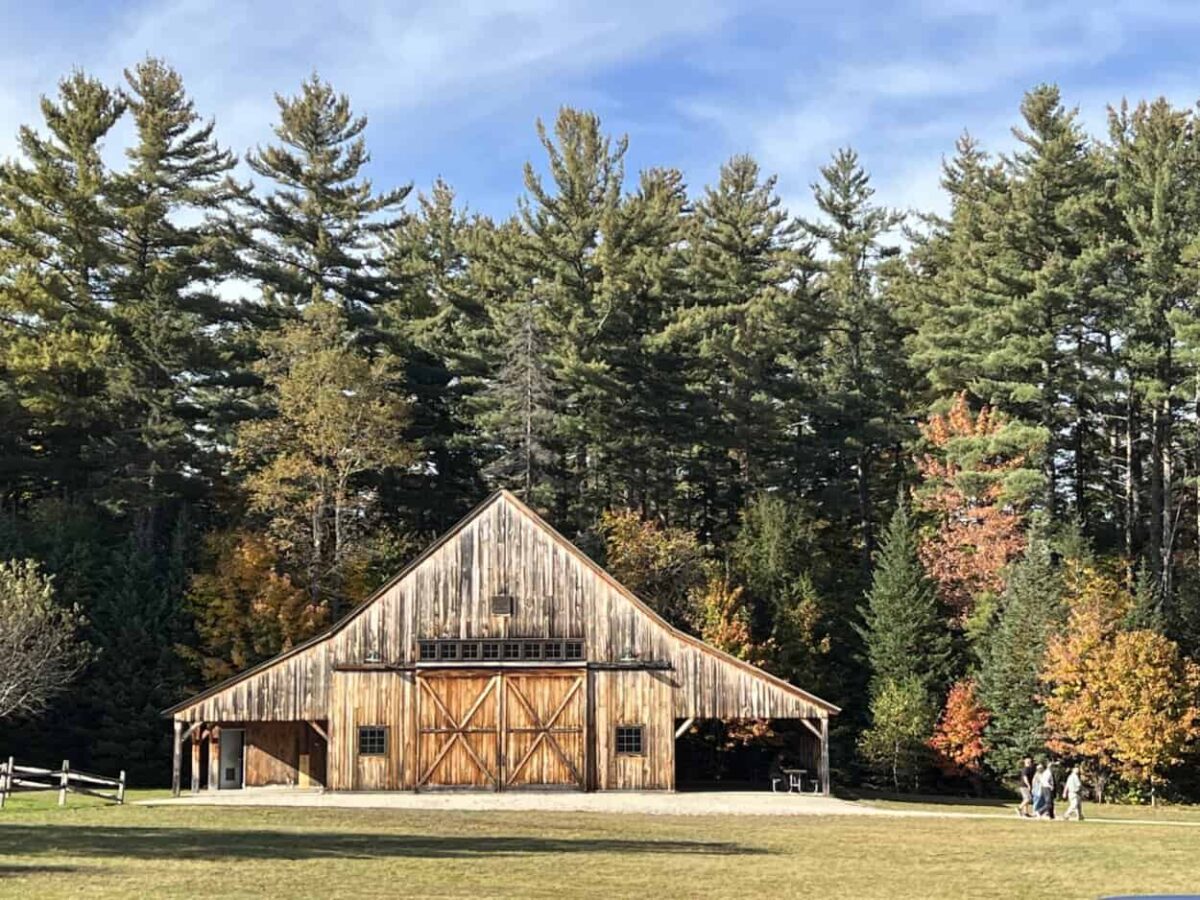
The Russell-Colbath House is the only remaining original structure from the town of Passaconaway. It was built in 1832 and is regularly open for guided tours from July through September. The historic site comprises the farmhouse, a timber-frame barn constructed in 2003, the Town of Albany Cemetery, and the 0.5-mile Rail N’ River Trail. At this stop, you will find parking, restrooms, picnic tables, and interpretive signs.
Although the house was not open during October, we enjoyed walking the peaceful grounds and gazing at the leaves adorning their autumn colors.
Sabbaday Falls (14.5 Miles)
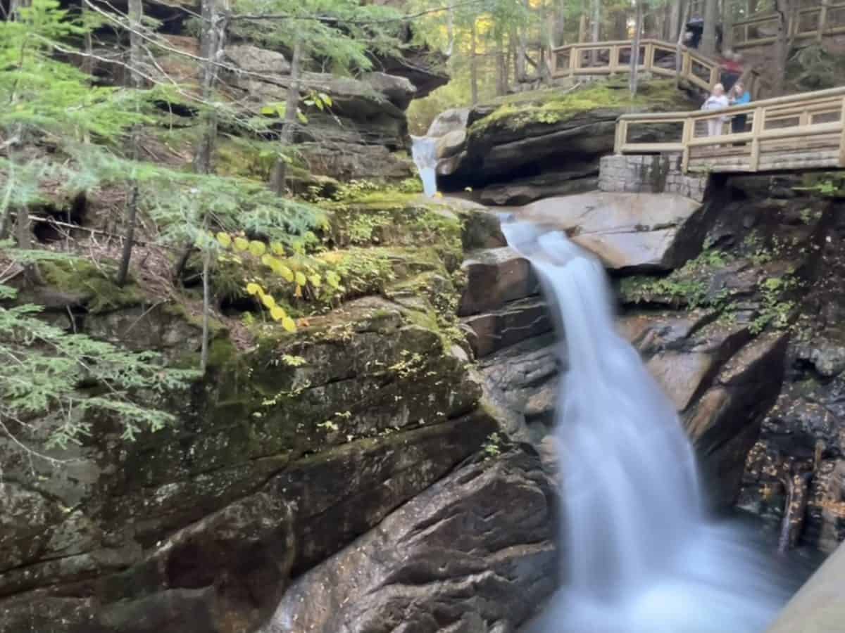
One of our favorite stops on the Kanc, Sabbaday Falls, reminds me of Flume Gorge in Franconia Notch State Park, one of the top things to do in New Hampshire. The 0.7-mile round-trip hike brings sheer joy as you walk along flowing crystal-clear water in a tranquil forest. A wide, evenly graded gravel trail leads you to the main attraction, a cascading waterfall through a narrow gorge. Boardwalks, stairs, and a bridge lead you up and around the cascading wonder, yielding views from the gorge and rim.
Julie and I found serenity at Sabbaday Falls, basking in the natural beauty and sounds of the forest. The different vantage points are rewarding. You get so much in return for such a quick and easy hike.
Sugar Hill Overlook (17.3 Miles)
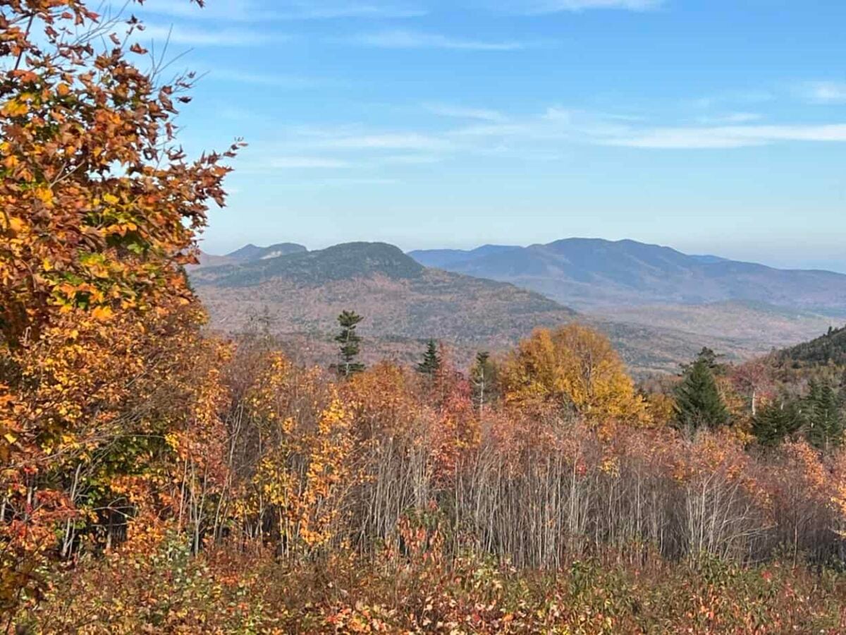
The Sugar Hill Overlook offers a panoramic view of the Swift River Valley and its accompanying mountains. Parking and interpretive signs are available here.
Although the mountains did not seem as prominent from this vantage point, you get a close view of many trees. If you arrive during peak foliage, it is a fantastic spot to see the landscape painted in bold red, orange, and gold.
C.L. Graham Overlook (21.7 Miles)
The C.L. Graham Overlook is also known as the Wangan Grounds, or “meeting place” of the Native Americans who lived and hunted here. At one time, the area was also a lumbering camp for storing supplies.
Today, it is an overlook on the Kancamagus Highway with a stunning White Mountains and Swift River Watershed vista. The overlook has a large parking area and interpretive signs.
Between this overlook and the next, you will see a sign for Kancamagus Pass, which is the highest elevation point on the scenic byway at 2,855 feet above sea level. You may want to stop for a photo.
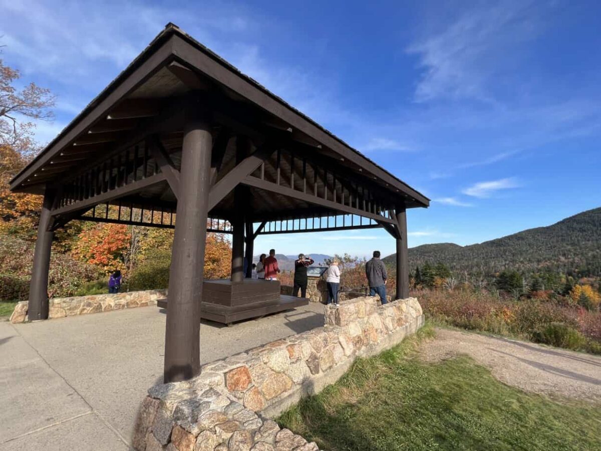
Pemigewasset Overlook (21.9 Miles)
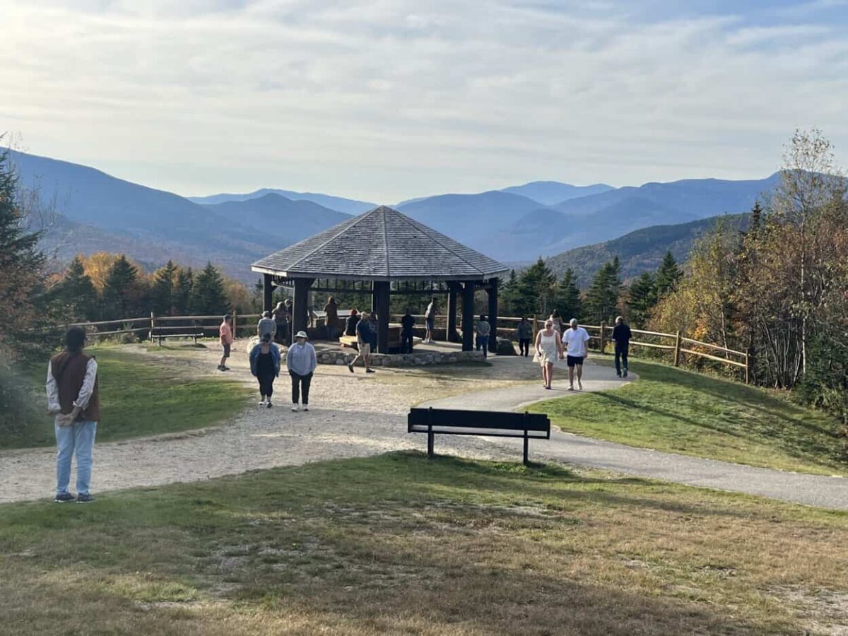
The Pemigewasset Overlook has a pavilion, interpretive signs, and, best of all, stunning views of the Osceola Mountains. Julie and I loved this overlook. There is something majestic about the pavilion against the backdrop of mountain ridges.
Hancock Overlook (23.8 Miles)
As you make your way further west, be prepared for the infamous hairpin turn. Hancock Overlook nestles in this area, offering shelter, informational signs, and stunning mountain views.
You will also discover the trailhead for Hancock Notch Trail, which connects to Cedar Brook and Hancock Loop. So, if you are interested in hiking, you have options from this stop. Julie and I savored the views at the overlook but did not trek along any of the trails from the Hancock Overlook.
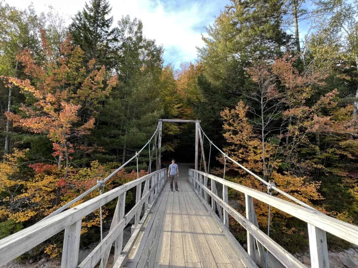
Lincoln Woods Trailhead (30 Miles)
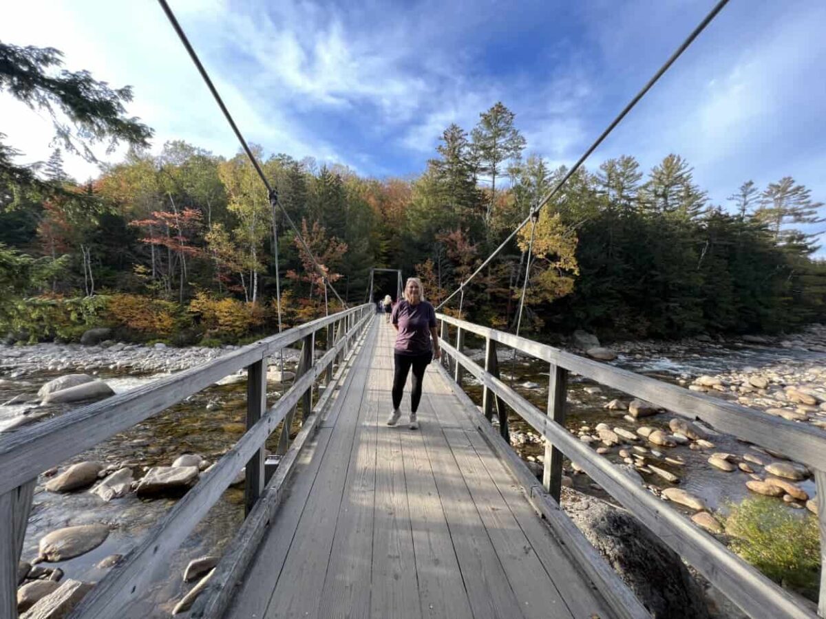
The Lincoln Woods Trailhead is an excellent place to stop for many reasons. It offers a large parking area, restrooms, information panels, potable water, and a cabin. The trailhead is known as the gateway to the Pemigewasset Wilderness, the most extensive in the northeast. From the trailhead, you can embark on leisurely strolls or lengthy hikes.
Julie and I enjoyed our time here immensely. Short nature trails lead to a wooden suspension bridge and a pedestrian bridge. Although the hikes are short, walking across the bridges is fun, and you will gain spectacular views of the rocky waters and surrounding forest. Those who want a challenge can choose between hiking options of nearly 7 miles or 10 miles in distance.
Attractions Near the Kancamagus Highway

Julie and I highly recommend riding the Mount Washington Cog Railway, the world’s first mountain-climbing cog railway. It takes you to the highest elevation point in the Northeast United States.
The Mount Washington Cog Railway is a 40-minute drive from Lincoln or an hour from Conway. We absolutely loved the train ride and the surreal experience of seeing clouds literally blow around your body at the summit.
Plan Your Road Trip
Although it does not have the fame and distance of the Blue Ridge Parkway, New Hampshire’s Kancamagus Highway delivers an exceptional scenic drive full of fun side adventures. If you want a scenic drive with jaw-dropping views of mountains, waterfalls, and fall foliage, add the Kancamagus Highway to your bucket list. It is the perfect way to spend an autumn day.
Featured image credit: Miles with McConkey